The Village with a Bridge
Bang Saphan is a small, rural town in the south of the province of Prachuap Khiri Khan. It's embedded between the Gulf of Thailand in the east and the Tenasserim Mountain Chain, which forms the border to Burma/Myanmar, in the west. In Thai language Ban[g] means village, Saphan bridge.
Wat Bang Saphan
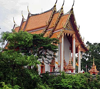
The vihar of the temple of Bang Saphan. It's placed on a mountain top closely behind the railway station, overlooking the place. Image by Asienreisender, 2010
The western border territory is coined by higher mountains of an altitude between 200m to 800m. The highest peak, Yot Khao Luang, reaches 1.251m. A lot of waterfalls are in the mountains, and there are still partially remains of tropical rainforest, although plantations, urbanization and poaching increasingly harm the remaining nature. Nevertheless, part of the area is officially under protection under national park status (National Park Namtok Huai Yang, 161km2).
The Gulf coast here includes beautiful, long sand beaches of whome the most are over many kilometers completely abandoned by tourists and infrastructure. Only plantations, many coconut plantations among them, stretch down to the coastline. Bang Saphan is generally spared by mass tourism; there are just a few individual travellers who make their way here and some Thais who come here for visiting the few beach restaurants. Nevertheless, there are some spots at the coast with coral reefs and marine life, where snorkeling and diving is possible.
Temple Bay
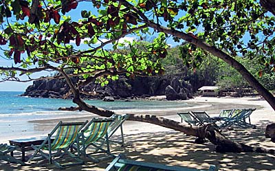
A small bay with a short sand beach a few kilometers north of town is temple bay (real name unknown, therefore self named due to the nearby temple. The image bottom left shows a standing Buddha on the temple ground). Some foodstalls serve good Thai food and one can squat in these very comfortable seats. Image by Asienreisender, 2009
Bang Saphan was already a city of the empire of Ayutthaya. The place's name was Mueang Kamnoed Nopphakhun then. Shortly after 1915 was the town renamed into Bang Saphan by the then king of Siam Vajiravudh (Rama VI). The whole district has 74.000 inhabitants (2013).
The place is connected to Chumpon in the south and Pratchuap Khiri Khan in the north by the Thai railway line which runs all the way from Bangkok to Hat Yai respectively further down via Butterworth (Penang) to Singapore. A few kilometers west of the town runs the Pethkasem Road 4, which mostly parallels the railway line.
Bang Saphan is said being a destination for a planned first nuclear power plant in Thailand. There is also a factory near the coast which causes pollution what brings it in conflict with parts of the local population. The factory has also built a small seaport at the coast.
The Gulf of Thailand at Bang Saphan
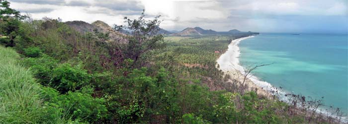
Along the shores of Bang Saphan's coasts are long sections of sand beaches, interrupted by hills. In the inland stretch huge coconut plantations. Image by Asienreisender, 2009