Mae Sariang
Mae Sariang is a small nest in the southern part of Mae Hong Son Province in north Thailand. It's a town at the banks of Yuam River on an altitude of 192m above sea level; the district is bordering Burma. Architecture and the presence of many Burmese Muslims give witness to the closeness and influence of Burma respectively her culture to the area.
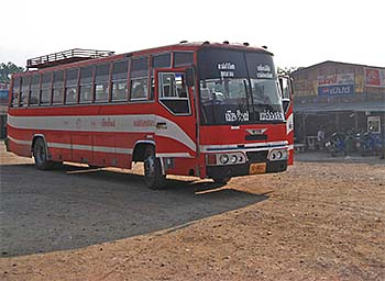
One of the good, old overland buses at Mae Sariang bus station. This kind of buses, where the passengers still can open the windows, are going to die out. Image by Asienreisender, 2/2007
The whole surroundings are coined by forested mountains whose highest peaks reach more than 800m (Thanon Thong Chai Range, east of town) and are very picturesque. As the whole border region to Burma/Myanmar, Mae Sariang is a magnet for refugees from the ravaged neighbouring country. At the very west, Mae Sariang District is even touching Salween River, one of the biggest rivers in Southeast Asia, marking here the border between Thailand and Burma/Myanmar. This is, by the way, the westernmost geographical point of Thailand. Salawin National Park is part of the district.
The best connection to the outer world is the road 108 to Chiang Mai. Another road connects Mae Sariang with Mae Hong Son and a third one southwards to Mae Sot, all along the Burmese border. There is also a small airport outside town.
Mae Sariang is on the so called 'loop' from Chiang Mai via Pai via Mae Hong Song via Mae Sariang and back to Chiang Mai. Due to it's remoteness and the many tribal villages in the surroundings, it becomes an increasingly attractive place for tourists who are interested in tribal peoples lives and trekking, the so called 'eco tourism'.
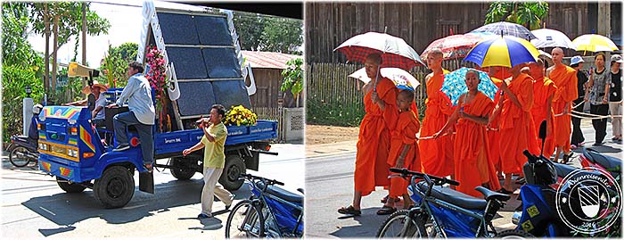
Everyday many people die. Here we see a funeral procession in Mae Sariang. Images and photocomposition by Asienreisender, 2/2007, 2016