1.
A Treacherous Way up
Hiking Mount Merbabu is somewhat treacherous. From the distance it looks very easy and not steep at all to hike up. The way starts easy on an asphalt road in Selo, what is also the starting-point village for climbing Mount Merapi.
At the right and the left of the asphalt road are a few houses and a lot of patches of vegetable fields.
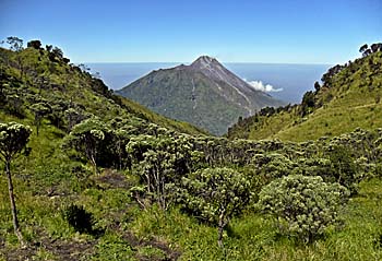
The vegetation above the treeline: it's Javanese Edelweiss, blooming in the months between April and August. This flower is endemic in Indonesia and grows in the mountainous regions of Java and south Sumatra. Image by Asienreisender, 2012
After a few kilometers the asphalt road ends at a bar and the unavoidable cashier booth. On Java one frequently pays even when climbing a mountain or entering a forest. Though, here it was not occupied. Too few people do the hike.
From the booth on the way is a forest path. The path leads a long way through a mixed forest. It's narrow and overgrown with weed and grass. One can't see most of the time were he is stepping on. Actually one shouldn't go there. There are maybe all these scary small poisonous monsters hidden in the green. But here it's not such a problem. It's too high for most snakes and scorpions. There are also no big lizards living here in the mountains. However, a walking stick would do a good job here in the forest, while further up when it's getting very steep the stick would be a burden. Anyway, one gets the trouser legs wet by the morning dew. Up to the hips. And one stumbles here and there over roots and stones.
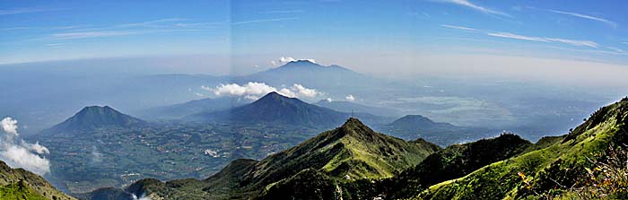
After an hour or so one comes out of the forest. Here are grasses, some bushes and a lot of different kinds of weed growing. Also fields of high reed are showing up here.
From this point on one can see a peak, and after walking upwards for such a while already it's tempting to suppose it to be the final peak. But it's not. The peak is still out of sight from here.
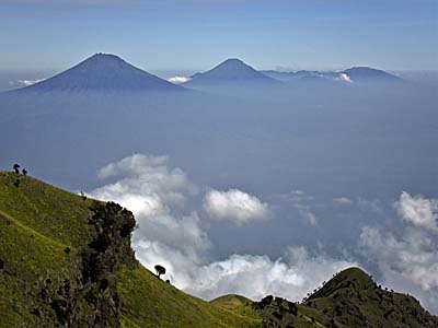
Above the treeline
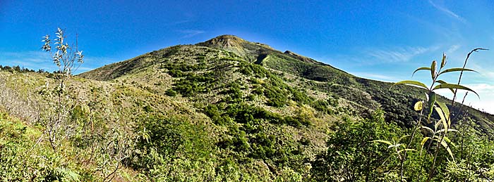
Leaving the forest offers this view on the mountain. However, the peak is still not in sight. Image by Asienreisender, 2012
At the first glance it looks also as the path now would be wider, but it's not. It's continuously covered with weed and still wetting the pants. Crossing a reed field one comes out to a small plain where it's possible to walk for a short distance easily. That's followed by a first very steep slope. Steps are made in the clayground. The Merapi is to see again in it's full glory.
After reaching the first peak one realizes that it's not the final one, but it's continuing over another short plain. Behind that there is another very steep slope, leading to another peak. That is a dangerous way up, for the steepness and the fact, that there is nothing to hold on. A wrong step or slippery could easily cause a long downfall for dozens of meters. That's advanced difficulty level. Later, on the way back I found out that there is another, much easier and far less dangerous way to go up.
Well, one is thinking now, that this peak is finally the last and highest one, but it's still not. After making it up there another plain appears, a few smaller peaks to the right and now, in the very background, the final, main peak of Mount Merbabu. Surprisingly still much, much higher to climb, still far away.
So, one walks over the plain and passes a small forest of a kind of mountain trees I have never seen before.
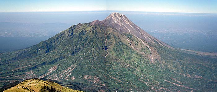
Mount Merbabu
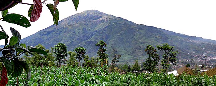
Mount Merbabu, seen from the valley of Selo. Looks smooth and easy on the first glance. Image by Asienreisender, 2012