1.
Kamphaeng Phet
Kamphaeng Phet is an old Thai town at the northwestern edge of the central plains of Thailand. It's a small place with about 29,000 inhabitants and namegiving for the province of Kamphaeng Phet.
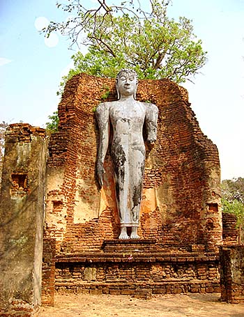
Image by Asienreisender, 2/2007
The town lies at the banks of the Ping River (Maenam Ping), which is a tributary of the Chao Phraya River. West and south of the place the surroundings are widely coined by agriculture, particularly rice paddies. The western parts of the province are mountainous and there are still forests left. In the past the grand teakforests of north Thailand begun here, but these majestic forests have been logged in an industrial style since the 1860s already and don't exist since the 1980s anymore. However, there are some national parks in the mountainous parts of the province.
Remarkably, there are oil and gas reseves in the province who are getting exploited. There are also marble quarries in the mountains.
The province gained some fame for a certain kind of banana, the 'egg banana' (kluai khai), a small and aromatic sweet kind of banana. There is an annual banana festival held here, with a cooking competition in banana recepies.
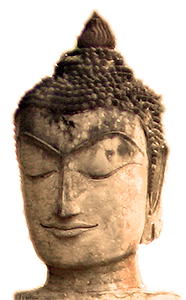
Traditionally, once in his life, any Thai boy or young man joins a temple and lives the life as a novice monk for a few weeks or months. Image by Asienreisender, Kamphaeng Phet, 2/2007
2.
History
In the province lived already people in stone ages, as some archaeological excavations prove. A first place here was founded in the 11th century. The original name of the place was Chakang Rao, a Mon name which might be an indication for the Dvaravati Culture. A Thai town was founded in the 1360s by king Lue Thai (reign 1347 - 1368) and called Nakhon Chum. Kamphaeng Phet was then a fortified place of strategical importance for the kingdom of Sukhothai. At an early time of it's history, the place changed location to the other side of the Ping River. It served as a bastion against Burmese invaders over centuries; that was still so after Sukhothai became incorporated into emerging Ayutthaya.
The city's name means as much as 'diamond wall', symbolic for the strong city walls who would protect the place against foreign conquest. The city's coat of arms shows parts of the city wall. Still today, the city wall is surrounding the old city. The wall is about 2,200m long and the walled area between 300m to 700m wide. In early 2007, I found the wall under restoration.
The historical town of Kamphaeng Phet had the same structural concept as Sukhothai and Si Satchanalai, means the religious sites were placed into seperate zones, both inside and outside of the walled place. Most of the building material is laterite bricks.
In 1991 Kamphaeng Phet Historical Park has been declared an UNESCO World Cultural Heritage, together with Sukhothai and Si Satchanalai.
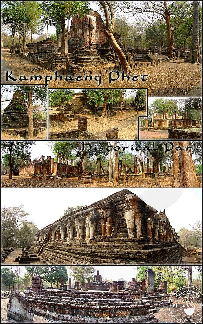
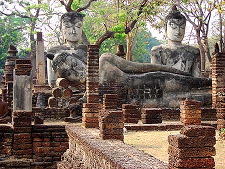
Impressions from Kamphaeng Phet Historical Park. It's a larger area which is kept very clean and tidy. Usually, as it seems, there are not many visitors in the park. Images and photocomposition by Asienreisender, 2/2007, 2016