1.
Chumpon Town and Province
Chumpon is a town at the Gulf of Thailand. It is situated at the Isthums of Kra, the narrowest geographical part of the Malay Peninsula. From Chumpon to Kraburi, where the Kra River flows into the Andaman Sea, it's merely 44km line of the crow. The distance to Bangkok is a bit less than 500km; there is a good road connection to Bangkok, the Phetkasem Road 4 and the railway line which connects Thailand's capital with Singapore. Chumpon marks also the point where Thailand's buddhist population get's more and more mixed-up with the southern muslim Malay population.
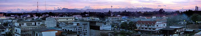
Sunset over Chumpon
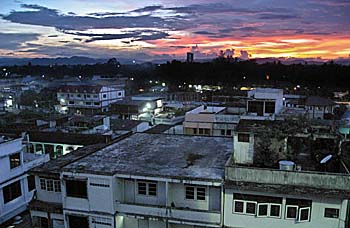
Image by Asienreisender, 2010
The population of Chumpon town is allegedly less than 34,000 (in 2012). However, the place is not that small that this number seems to be believable. I would estimate it much higher.
Chumpon is also the capital of Chumpon Province. The climate of the region is coined by the northwest monsoon, which brings rain between May/June to January. The heaviest rain falls in October and November; in December and January it can be quite stormy. Legendary was the typhoon Gay who hit Chumpon in 1989 and destroyed verymost of the province's plantations and caused a great deal of more damage. In the past there were seasonally high floods infesting the place and the region. When I arrived here on an August day in 1996, the whole town was under water. As further away from the railway station as deeper the water got. The elevation lowers in this direction towards the coast. Meanwhile there has been a large canal drainage system implemented to prevent the town and it's surroundings from such flood disasters.
In the past the town was bordered by Tha Taphao River (Maenam Tha Taphao); meanwhile the settlement spreads out more and more south and east of the river, particularly along the broad road no. 327.
Chumpon Inner Town
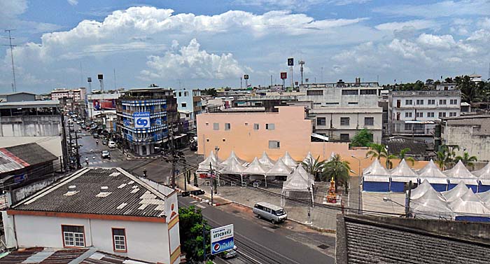
This crossroads marks, at least for me personally, the town's center. The road below right to top left crosses the whole town and leads still a considerable distance straight on until a big sport stadium. That's a great place to do some physical exercise in the evening. Actually any Thai province capital has such a stadium, which is often extended by a spaceous park with much green. Entrance is always free and there are even some sports facilities included.
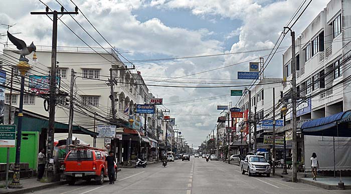
Merely 50m or 100m at the right side is the town's fresh market located, with a large part with fish stalls. There is also the stop for the local songtheaws (kind of pickups with roofs and benches who serve as means of transport, replacing the lack of a public transport system). The yellow songtheaws go out to Hat Thung Wua Laen Beach. Image by Asienreisender, 2012
Typically for Thailand's cities is this egg carton like building style. Naked, soulless concret. Modern industries produce merely functionally and as cheap as possible. As more developed our world becomes, as worse get's this process. Production is not for human needs; it's for profit generation exclusively. Image by Asienreisender, 2012
2.
Landscapes and Economy
The landscapes of Chumpon Province are coined by large savannahs in the plains, where was formerly tropical lowland rainforest. Most of it has been transformed into plantation economies, particularly fruits as mangosteen, longkong, rambutan, these small and delicious 'finger bananas' and durian as well as coffee, coconut plantations and palmoil plantations.
The Coast of Chumpon
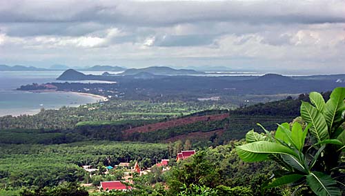
From the feet of the Tenasserim Mountains the terrain falls slowly down towards the Gulf coast. The green is all plantation economy, except on the steep slopes. Image by Asienreisender, 2010
The west of the province is bordered by the Phuket Mountain Range, a subrange of the Tenasserim Mountain Chain. The mountains dont' reach higher than 400m here and are relatively untouched and offer still a larger refuge for wildlife. These limestone mountains are penetrated by many caves, most of them bizarre stalactite caves who are home for many bats. However, the Phetkasem Road 4 (Asian Highway 2) is cutting through the mountains and has been massively extended in around 2012. This main road leads via Kraburi to Ranong and from there further south to Phang Nga, Krabi and back to the Gulf coast at Phattalung. There are also some tin mines in the mountains, but most of them are exhausted since long.
The Tenasserim Mountains at Chumpon
View over the western parts of Chumpon towards the Phuket Mountain Range. Image by Asienreisender, 2010
Chumpon town lies some seven kilometers west of the Gulf of Thailand. The Gulf coast here has longer sections of sand beaches. Some of Chumpon's beaches are touristic, but Chumpon is no destination for mass tourism. It's rather a transfer point for many tourists who pass through here on the way to the island of Ko Tao. The whole coastline of Chumpon Province is 222km long.
Islands of Chumpon
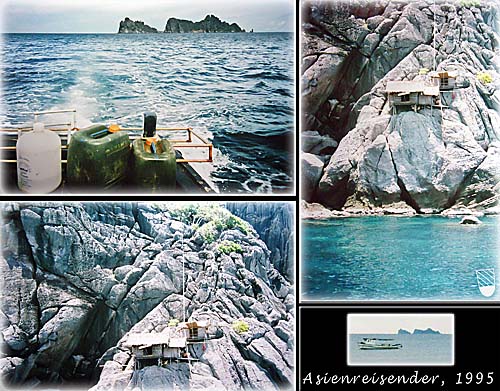
On a boatstrip to the islands of Chumpon. Sometimes it's called 'Chumpon Archipelago' here, although that's probably no geographically accepted term.
Snorkeling or diving here means diving into a strange, tropical underwater world. Colourful fish in great swarms, corals, plants of all kind, seacucumbers. A bit apart of the island the seaground falls at an edge suddenly so deep that it's pitdark down there. The day before there have been some whales seen at the spot of a length of eight meters.
The islands are uninhabited. The shacks here are a base for the swallow nests collectors. These nests reach a high market price. There is a lot of bogus in current around concerning the medical and magical power of animal parts or products.
Images and photocomposition by Asienreisender, 1995, 2015
The beach Hat Thung Wua Laen is about 17km away from town. It's a longer sandy stretch along the coastline with some guesthouses, resorts and restaurants. It's the main tourist beach, but not overrun by tourists.
In this section of the Gulf of Thailand are numerous islands, most of them are small. There is also an industry exploiting the swallow nests on these islands for the peculiar needs of some Chinese customers.
The sea is of course also exploited by many fisheries who contribute to the local economy.
As practically everywhere in Southeast Asia there is a rapid growth going on in Chumpon. The town is getting extended massively by a new ringroad system which will spawn a lot of sideroads with the exhaustive urbanization as usual nowadays.
A Tropical Coastline
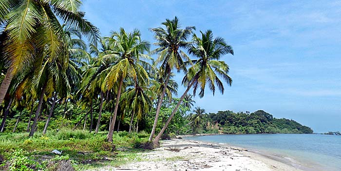
The northernmost end of Hat Thung Wua Laen Beach. Image by Asienreisender, 2012
3.
Sights
There is actually not much what could be counted as sights in Chumpon. Inmiddle of the boulevard in front of the railway station there is an old, impressive steam locomotive placed. It's worth to have a look for it.
Historical Steam Locomotive
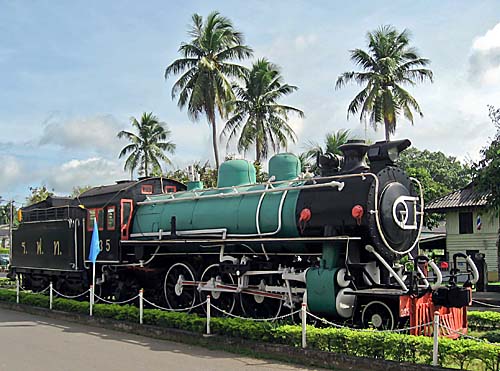
At many stations of Thailand's railway system are old and nicely restored steam locomotives placed. That's a great idea, much better than to demolish them into oblivion. I have never seen that in any other country. At the best, very few end up behind museum walls.
I guess this locomotive of from the early 20th century. Image by Asienreisender, 2010
A bit out of town, but still in walking distance, lies the National Museum of Chumpon in a greater, parklike area. It's a modern building which opened in 1995. Inside are some artefacts from Chumpon's past to see. The area has been inhabited already thousands of years ago. There are some photographs, a town model and a display of the events of the typhoon gay in 1989. There is also a section of the events in the Second World War. Chumpon was one of the eleven landing points of the imperial Japanese army in December 1941.
Some 50km north of Chumpon town is a huge and remarkable stalactite cave, Tham Pisdahn, which is worth to be visited. One has to climb a great deal of stairways up to the entrance. There are few tourists going - I personally didn't meet a soul. A torch is necessary, although the cave is partially electrified. At the foot of the mountain is a wat (buddhist temple). The monks care for the cave and can do some guiding. In reverse it's certainly appreciated to give a donation.
Chumpon's Railway Station
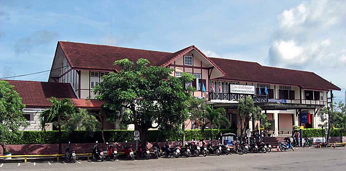
Chumpon's railway station represents an European frame-work architecture.
Unfortunately the railway system is neglected in any country worldwide for the sake of private bus companies. Factually the railway is the much better transport system.
Image by Asienreisender, 2010
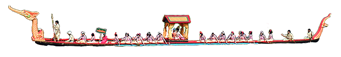
In Lang Suan is a traditional Boat Procession and Boat Race held every year in October. This tradition dates back to 1844 in the reign of king Rama III. Highly decorated boats with boatsmen and representatives in colourful traditional costumes perform races or display their arts.
Grand Barge Festival
Photocomposition Lang Suan 2012
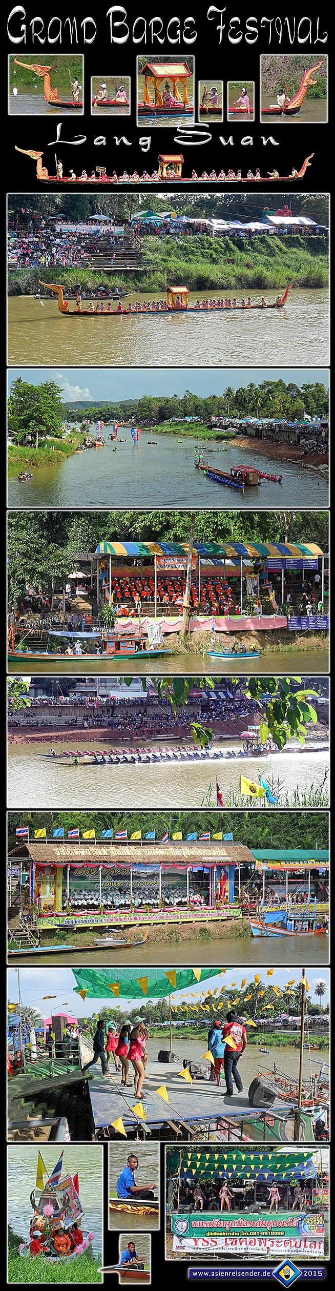
It was to my very surprise to run accidentally into a Thai barge procession in Lang Suan on 3rd November 2012. Boat races are a common event in many Thai cities and towns, but a barge procession is something I knew till then only from Bangkok.
Allegedly the royal Thai barge processions date back into the 14th century Ayutthaya. The first Westerners reported about the event in the 17th century (see: Simon de la Loubere; 'A Depiction of the Kingdom of Siam'). The processions happen only at certain cultural or religious events, not frequently. However, the procession and boat races in Lang Suan do happen annually around the 1st of November at the occasion of the 'Buddha Floating Procession'. They last ten days then.
There is a similar tradition held occasionally in Phnom Penh, Cambodia. Certainly it has the same cultural roots, and it may be that the medieval Khmers where those where the Thais got the tradition from.
Traditionally the procession is accompanied by music and rythmic drumming to give the rowmen a tact. Some of the barges are designed for the royal family, others are war barges, manned with warriors. Here the spectacle is accompanied by dancing girls with apparently their pimps in the background and a deafening din of contemporary music out of monstrous loudspeakers.
All images and photocomposition by Asienreisender, 2012, 2015
4.
History
The area around Chumpon has been inhabited by people already in prehistorical times. In medieval times Chumpon existed already as a town in the 7th century and was a tributary of the powerful kingdom of Ligor (Nakhon Si Thammarat). In the time of Ayutthaya Siam, Chumpon was an important place in the south of the empire. It contributed also troops in the wars against the Burmese. The province of Lang Suan south of Chumpon was incorporated into Chumpon Province in 1932. Lang Suan is the only other town in the province besides Chumpon itself.
The seal of Chumpon shows an angel (thevada) who is praising the people. The spirit is placed on a lotus-pedestal, framed by two of the local fig trees (ficus racemosa). In the background are a fortress and two watchtowers to see. That's a reminiscence to the time when the king of Ayutthaya called for troops here in the wars against the Burmese.
The Canal System
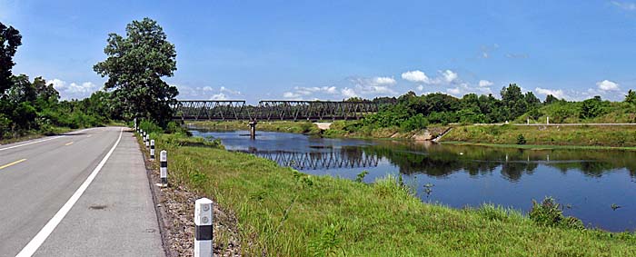
This canal is part of a huge, new canal system surrounding Chumpon. As a response to the annual floods it's draining the water now. The canals are flanked by new asphalt roads and partially dirt roads. One can follow them over many kilometers. Image by Asienreisender, 2012